Friday, December 31, 2010

Lahore Doodh Patti Restaurant in Kaohsiung, Taiwan


Two years ago we had brought you a report on where to find Daal-Roti in Taipei and today we’ll do the similar report for Kaohsiung.

With a population of 2.8 million, Kaohsiung is the second largest city of Taiwan. While the city is fast turning into a cosmopolitan business center, Pakistani food still has to make inroads here. One restaurant that is breaking this barrier in Kaohsiung is called ‘Lahore.’ It is located on Lin Chuan Street and today I got a chance to eat there and had a quick chat with the owner who goes by the name of Ali. (Our title photo to the top right shows the main sign board of Lahore Restaurant on Lin Chuan St, Kaohsiung.)

Ali told me that his business started as a small stall serving Pakistani chicken wrapped in chapatis and today it has grown into a proper restaurant with a seating room for approx. 15 people.

‘Lahore’ restaurant has quite a few Pakistani dishes on the menu but to cater to their 99% Taiwanese customers, they have experimented with Pakistani-Taiwanese fusion dishes. (The photo to the left is one of the Biryani dishes we ordered.)

One should not expect to find authentic nihari, haleem or Lahori chargha here but they do sell the food that is closest to Pakistani food one can find in Kaohsiung.

Lahore restaurant now boasts of a very long menu with Pakistani, Taiwanese, Mexican and Mid Eastern dishes on it. In the following photo I’ve tried to capture their Pakistani portion of their menu.

I should say that the ‘chapatis’ of Lahore Restaurant are a must try. While I was having my lunch here, I noticed that Ali started making ‘chapatis’ from scratch which means he started with white flour, made a dough out if it, and then cooked them on an inverted heated pot. ‘chapatis’ don’t get more authentic than this. I commented to him that this was quite a hard work to make chapatis from scratch, to which he replied: “This is what makes us special.”

My family, friends and I ordered a couple of Chicken curries, Chicken Biryanis, and Mango lassis. Tea, Fruit Custard and Salad came as part of the ‘combo’ meals we had ordered. (Photo to the left is a cup of tea that came with our order of a set – combo).

The quantity of food was enough to fulfill our hunger. I want to say the same thing about the taste but my journalistic responsibility will only allow me to repeat the sentence that it is the closest Pakistani taste you can find in Kaohsiung.

(Photo to the right is the mango lassi you can get at Lahore restaurant.) Ali, the owner of the restaurant speaks fluent Chinese, which bodes well with his Taiwanese clients. He also speaks perfect Urdu – which made chatting with him easier for me. I must say that I was surprised to see a Pakistani owned restaurant with a name like ‘Lahore’ in Kaohsiung, therefore this fact alone has qualified this post for ATP.

I will recommend a trip to Lahore in Kaohsiung if you happen to be there. And now when all is said and done, I observed the following notice pasted in the restaurant.

The notice says that restaurant will be closed for few weeks starting mid January 2011 because the owner is going back to his home country.

The language of notice brought me smiles as well as the observation about so many immigrant businesses who don’t get any choice but to close their businesses when they have to visit their native countries.

Happy New Year

As I say Happy New Year to all my friends and readers and greet the start of the next year, here is the list of articles the characterized 2010 through my blogs. These articles reveal how I will remember 2010.

I am sure some of these articles will allow you to relive the memories of the past year while some others will let you how I was right (or wrong) when I wrote them. List is long. I suggest you have a cup of Doodh Patti, sit back and while you say farewell to year 2010.


Social Media in the Attention Age
Blogging in Rage
Identity Access Management
Cyber World is Not in Safe Hands
Plagiarism, Prove it!
Chaudhry Norbert Pintsch and the Appropriate Technology
Why telecommuting trend is not picking up
Art for Allah
The Nizam Sahib, I think I know
What Are Criminals Made Of?
Changing Chitral
Pakistan blogging era
Thatta Kedona reach out
Calling Pakistan marketers and advertisers
How to make money online in Pakistan
Sanjh story
Flood and the Taliban
Pakistan Flood 2010
Pakistan economy
Harrapa
Jalal HB on Fine Art of Blogging
Mud architecture in Pakistan
Revival of Mud Architecture in the world
Summer camp in Gupis
Pakistan cricket
Changing outlook

Monday, December 27, 2010

Travel writing

Travel writing is a fine art; accepted literary genre that is read. Writers who are gifted with an ability to understand what they see can breathe life into a place when they narrate their travel experiences. The Internet that is wrongly considered a pedestal for instantaneous scribbles mixed with emoticons and indecipherable abbreviations has already become a place to find some good travel literature, travelogues and travel stories in addition to online trading of travel services. It can be one of the best display places for local writers to showcase what Pakistan has to offer.Travel is prosperity and leisure pursuit, which is a result of many things: history, heritage, culture, natural beauty and a quest to know what is unknown and meet wonderful people.

Pakistan is a land of geographical, geological, and natural contrasts and has every thing nature could bestow; from some of the places like Mehr Garh in Balochistan and Harappa in Punjab where some of the initial human activities began, Lots Valley (NWFP and people there) once home to Gandhara Civilization where Chinese Hiuen Tsiang who is regarded as an early trendsetter traveller treaded, or ancient city Multan that, as per the legend, is living since the time of Hazrat Noah (A.S.), Kalash community existing in an on the edge district Chitral still holding awaiting for anthropologists’ conclusive research about origin of their unique identity against all outside pressures for development and modernity, unsolved riddle where rivers were lost (River Hakra in Cholistan) to pristine locations in Northern Pakistan (tree line in Himalaya Range) where one can see two seasons at the same place — winter above and summer below, and thematic pilgrims for Sikh and Buddhist communities, to name just a few.

Now consider this: All major national publications have some portions designated for travel writing but it is a small and competitive market. For those who write in English — language that is understood on World Wide Web – the market is even smaller. Experienced travel writers are associated with newspapers and magazines and new ones get chance to appear in print only occasionally. The print publication should open more opportunities for travel writers.

There should be more travel journalism and industry news. Public should know if the Ministry of Tourism reduces royalty fee by 50 percent for climbing Pakistani mountains that are above 6000 meters.

Facts packed guidebooks with eye-catching, superb, clear and sharp images of people and places enlivening every page provide good background information into any country’s history, culture, attractions, and its people; information that are useful during journeys to new places. Guidebooks have their own style quite different that travelogues and travel stories. The guidebook publishing business is totally in the hands of famous foreign companies and it is hard for local publishers to compete with them. “Only foreign tourists need and buy guidebooks and they already have one when they arrive in Pakistan,” says a publisher Munir Ahmad. Still opportunities for travel writers do come up from time to time. Some guidebook companies also get updates and inputs from local writers and photographers that appear in their newer editions. Some time ago, for example, Insight Guides commissioned a local writer to revise their outdated edition. Tony Wheeler, British founder editor of Lonely Planet while marketing guidebooks on Pakistan prides in growing up in here for some years and has contact with many local travel writers for updates. But, Munir Ahmad says, “Publishing guidebooks is not a viable option here; it is difficult to sell books.” Same is the case with self publishing by writers.

Given the rate of travel industry growth and every one’s interest in knowing new places, people and cultures, so many Websites have come up that show travel contents all over the Internet. So far Pakistani destinations have very scanty presence on the Web. Print publications, particularly English, get the original work and pay to the writers whereas most Websites just recycle travel articles from print media.

This scarcity of places where to get published leaves the travel writers to turn to the Internet where they can pitch their ideas to many editors of travel Websites and or interested foreign publications who are always looking for new talent; eager and encouraging. Not only that, writers can read what has already been published there, find background material and facts. Quick search on the Internet reveal so many starting points, notwithstanding travel writing how-to services and premium travel writers’ marketers. BootsnAll.com, where I am published some time, is a Web service that post articles by writers from all over the world. I have found it writer friendly and receptive to new locations.

In Pakistan, so far much has not been documented systematically what to talk of presenting it on the Internet for others to find about with an aim to tempt them to come here and see (and spend their money in the process). Which is why Pakistani travel writers and photographers have a vast field of activity on hand right at home? In addition to glob trotters with a compass, a camera and itchy feet, historians, geographers, archaeologists, geologists, naturalists and birdwatchers also need to publish their work in order to generate wide ranging interests in off beat and mostly obscure destinations in Pakistan. I know an engineer Itehar Mahmud who works with oil exploration firm and writes about places where ever he goes in connection with his duty. Mobashir Ahmad has travelled all along the borders, “for recognisance purposes mostly on foot,” he says, during his long service. He also writes his memories from the Salt Range (and Katas Raj) to Jhang and more in the form of travelogues. It is in this context the Web can be viewed as the playing ground for local talent.

Travel calendar of Pakistan is quite impressive. Where else in the world other than in Pakistan polo – grandest of all the sports — is played at the high ground like Shandor Pass that is called the roof of the world, or moving international cultural festival are held along Kharakorum Highway. But all the events on the calendar go without any advance publicity or follow ups. One wonders how interested people come to know about these events. PTDC list of events and festivals need to be improved and lot more can be included in the list.

Somebody has to write the travel literature in order to keep fuelling the demand for airline seats, hotel rooms, tour operators, eateries, transport companies, porters and facilitators, guidebooks, atlases, picture postcards and posters publishers, and other affiliates of the travel industry besides those communities whose major source of income comes from tourism. Kim Rahan, a traveller from China who bought History of Rohtas Fort on location, told, “This buy is to promote interest of people in travel related vocations.”

Too often, deftly executed travelogues or a travel story can accomplish much more than any other promotional activity, particularly a story that combine passion, personality and perspective. Every place has a story (and a history), as they say. If you have a drive to write, there is a need of extensive travel writing showcasing Pakistan  from Pakpattan to Pashin on the Web.

Gift Economy

Helping others is one of the most cherished acts. Those who are in a position to help and generously help those who are in need are blessed fold. Giving gifts and donations have always been a part of every culture across the world since perhaps the start of civilization. In this modern age, the forms of giving gifts have changed. Also many services have come up who help those who want to donate and these services then help.

Given my own interest, I came across kar4kids while looking online. One of the best nonprofit organizations that is helping people with car donation and proceeds are spend in different programs to help needy kids and their families.

They have made the process simple and hassle free. Complete their online form, they will arrange a free pickup and you will get tax receipt and what is more, you have free vacation voucher waiting.

Explore the site and learn more about Car for Kids and what they do and how your used car donation can go a long way to change the world. The site is neatly laid out, uncluttered and users friendly. Everything is clearly explained and whole thing is very transparent. Donate car and join the cause.

Saturday, December 25, 2010

Risky river crossings


Located in the Abbottabad District of Pakistan’s Khyber Pakhtunkhwa province, the Haro river can only be crossed using the makeshift cable cars. These cars run on rusting iron cables, which were purchased from a scrap dealer and installed without inspection by qualified engineers.


The cable cars are used as a regular means of transport by those attempting to travel from one village to another. One has to pay Rs. 10 to cross Haro River by any of the seven such locally made cable cars.

The locals see the cable cars as a convenience and are blissfully unaware of the dangers of using it. On the other hand, the owners are only concerned with the Rs. 1 income per passenger, and the operators only know how to push the start and stop switches.

Local police personnel are unconcerned and have taken no action yet.

One local resident, a daily passenger on the cable cars said, “We are afraid of the risks, but then being Muslims we believe we cannot die before our appointed time, can we?”

It is extremely hazardous and unsafe to cross the river using these dilapidated, rusty structures. Local authorities need to take urgent action to replace these cable cars with newer and sturdier models, before they snap and cause casualties.

Thursday, December 23, 2010

World Travel Market

Every November the world’s travel and tourism industry, including senior executives and more than 150 tourism ministers, arrives for the annual WTM at London’s international exhibition and convention centre ExCel. It is the event at which the travel industry negotiates the deals that ultimately decide which holidays will appear in next year’s brochures, travel agencies and on travel websites worldwide.

Lorraine Samuel, senior client services manager, Business in Africa Events UK Ltd, says of last year’s WTM: “It was a great opportunity to network and exchange ideas on current trends, such as using tourism to encourage economic growth within a destination. The event gets bigger and better every year.”

WTM 2009 saw more than £1,139 million worth of business conducted, and this year’s show is poised to generate even more business deals, all of which will have a direct bearing on where we go on holiday in 2011 and beyond.

Turn to page 19 for inspiration on next year’s hot destinations — all of them represented at WTM. Among the more far-flung countries highlighted are Peru, Libya and Nepal — no longer the preserve of hardened trekkers.

Iraq is exhibiting at WTM for the first time in more than a decade — could the once unstable country be a tourism hot spot of the future? A delegation from the country’s ministry of tourism attended WTM last year, helping it secure a number of investments in its tourism infrastructure. With leading hotel chains building properties there and airlines now flying to the destination, this could be one to watch.

New to WTM 2010 is the Sports Pavilion, a testament to the huge growth in this sector of the travel and tourism industry. As the UK gears up for one of the biggest events in its sports tourism sector — the Ashes in Australia, starting November 25 in Brisbane — find out how to plan your holiday to coincide with this and other major international sporting events. These include next year’s Rugby World Cup in New Zealand, which will see thousands of rugby fans from the home nations visit the pre-tournament favourites, and the One Day Cricket World Cup in Sri Lanka, India and Bangladesh.
With its hosting of both the 2014 FIFA World Cup and the 2016 Olympic Games, Brazil is set to be a major tourism force in the coming years. Read more about developments here.

Responsible travel remains a key consideration for both consumers of holidays and the travel industry, which is why WTM is dedicating an entire day to this topic. These days, an increasing number of holidaymakers choose to travel responsibly, and the destinations to which you can travel and limit your impact on the environment, or make a real difference while you’re there, are growing.


Ten years ago there were very few responsible tourism operators; today there are more than 300 selling 4,000 holidays. The responsible travel feature highlights Puerto Princesa in the Philippines as a shining example of how a community project is allowing visitors to experience one of nature’s most magical sights — the dancing fireflies of the Iwahig River.

I hope you enjoy this special World Travel Market supplement and that it gives you plenty of food for thought for your 2011 holiday plans and beyond. [Via]

Wednesday, December 22, 2010

Fine Art of Bloggging

Fine Art of Bloggging - This article appeared in in Sci-Tech World daily Dawn

Travel with Owais Mughal

Owais Mughal

In November 2009, we started our virtual journey on N55 Indus Highway from its zero point at Jamshoro (N55-Part I) and today after 13 months of stop and go journey we will hopefully reach its end on the Ring Road of Peshawar. When we reach there we will have covered 1256 km.

Following photo is N55′s approach to Friendship tunnel between Kohat and Dara Adam Khel – one of the landmarks you’ll see on today’s travels.


For a quick recap, in Part II we had traveled on the right bank of Indus and driven 333 km to reach Dera Ghazi Khan (N55-Part II). In Part III we covered further 214 km to reach Dera Ismail Khan (N55-PartIII) . Lets try to reach Peshawar today. It is 334 km from here and it reminds me of a naara which I once heard from participants of a juloos (procession) in Liaqatabad, Karachi which was going Peshawar “by foot” in 1990. One of their leaders was shouting on megaphone “Peshawar dur hai” and everybody else in the procession replied in chorus “jaana bhi zaroor hai”. These guys were apparently doing Karachi-Peshawar long march for some unknown demands. I was passing by on my Yamaha 50 and all I remember was this naara. So for us today on N55 – after a gap of 20 years – lets raise the same slogan again:
Peshawar dur hai
jana bhi zaroor hai
Today we’ll start our journey just north of Dera Ismail Khan and the first town that we’ll pass through is called Yarak.

Yarak (km marker 964)

Yarak is a small village 33 kilometers north from D.I.Khan city center. From Yarak a small road branche off from N55 towards east and goes to Chashma Right Bank Canal. Yarak is also sometimes spelled and pronounced as ‘Yarik’.

Kulachi N55 Link Road (km marker unknown)
Few kilometers north of Yarak, this link road branches to the West and meets D.I.Khan-Tank road at Gara Hayat and then connects to the town of Kulachi.

Lucky Cement Factory (km marker unknown)

Just few kilometers before Pezu, Lucky Cement Factory is located on the east side of N55.

Pezu (km marker 990)
Pezu is a junction point for a link road to Tank which branches off from N55 towards west.

Shahbaz Khel (km marker unknown)
Tittar Khel (km marker 1011) (also called Tattar Khel and Guli Jan)
Ghazni Khel (km marker 1017)

Ghazni Khel is a junction point with link roads leaving east and west off N55. The road to the east connects to a town called Kaka khel and the road to west connects to a town called Khaira Khel.
Laki Marwat Link Road Junction (km marker unknown)
Few kilometers north of Ghazni Khel, another east-west link road connects N55 to Laki Marwat towards east and Khair Khel towards West.

Tochi River N55 Bridge (km marker unknown)
Sarai Naurang (km marker 1048)

The new alignment of N55 does does not enter Sarai Naurang but few kilometer before the old town center it takes a sharp right to bypass the town. The old alignment of N55 (now called Bannu Road) goes to Sarai Naurang and then onwards to Bannu.

Bannu (km marker 1073)
Bannu was served by the old alignment of N55. Currently the highway bypasses the city but there are link roads which connect the city center to N55.

Bannu is also the largest town on this section on N55 between D.I.Khan and Kohat. Bannu’s population including the cantonment in 1998 was 46896.

The present day Bannu city was fiunded in 1848 by a Britisher Sir Herbert Edwards and therefore it was initially called Edwardsabad. For some years it was also called Dhulipnagar (or Dalipnagar) named after its main bazaar as well as Dhulipgarh (or Dalipgarh) named after its fort, before its current name Bannu took over.

Bridge over Kurram River Tributary (km marker unknown)
Latambar (km marker 1011)
Latambar is also bypassed by the new N55 alignment. The old N55 – now called Bannu Road connects Latambar town to the new alignment.

Bahadur Khel (km marker 1117)
Khurram Muhammad (km marker 1127)
Jata Ismail Khan (Km marker 1159)
The four towns listed above are located on old N55 aligment called Bannu-Lachi Road and Thal-Lachi Road. Some portion of old N55 is called Bannu-lachi and from a junction point onwards from where a link road heads to Thal it is called Thal-Lachi road. The new N55 bypasses all of these towns but runs in parallel to Bannu-Lachi and Thal-Lachi Roads.

Ahmad Khel (km marker unknown)
Ahmad Khel is located on N55 new alignment before the town of Lachi.

Lachi (km marker 1169)
Lachi is the junction where old alignment of N55 and new alignment meet again.


Gada Khel (km marker unknown)
North of Lachi, this is the junction point for a link road heading west to Hangu.

Kohat (km marker 1196)


Population of Kohat including cantonment in 1998 was 125271. 

N55′s new alignment has a bypass for Kohat and several roads from Kohat connect to N55. The old N55 alignment that goes into Kohat town is now called Bannu Road. Then there is Indus Highway Link Road, Rawalpindi Road, Kohat bypass Road, an unnamed road and Kohat Road which connect Kohat city center to N55.

Friendship Tunnel (km marker unknown)
ATP had a very detailed post dedicated to Kohat Tunnel itself. 

This tunnel cuts down the distance between Kohat and Peshawar (and hence the length of N55) by 25 kilometers, which is definitely a great saving in time (40 min) and fuel for people traveling here.
A signboard on N55 near Friendship Tunnel on North bound road.

Dara Adam Khel (km marker 1220)
Matanni (km marker 1240)
Peshawar-Hayatabad Road Junction (km marker unknown)
Peshawar (km marker 1265)

N55 ends in Peshawar (or starts from Peshawar in down direction) from a place called Gulshan Rehman Colony and Garhi Qamar Din located on Peshawar Ring Road. From Ring road to Peshawar City Center the old alignment of N55 is called Kohat Road. The map to the left shows the end (or starting) point of N55 at Peshawar Ring Road.

According to 1998 census, population of Peshawar City was 982,816. ATP has covered portions of Peshawar in following articles, which I’d like to present here:
1. Masjid Mahabat Khan, Peshawar
2. How Islamia College Peshawar Lost its kullah
And this completes our 1265 km journey on Pakistan’s second longest national higway – the N55.
References:
1) Google maps (googlemaps.com)
2) National Highway Authority, Pakistan (nha.gov.pk)

Monday, December 20, 2010

Doodh Patti Mind


Gujrat - claims to fame

While cities are dynamic centres of creativity, commerce and culture, these benefits are often undercut by environmental problems, lack of civic amenities, inefficient governance, and administration. Centuries old historic city Gujrat is a classic example where one can see all the hazards of urbanization’.

Commuter who prefer to drive on familiar and congested Grand Trunk Road rather than going on isolated Islamabad-Lahore Motorway pass through Gujrat city that has stretched from bridge on the River Chenab to the bridge on Bhimbar Flood Stream.

There are many tales about the remote origin of the place. As per one legend Gujrat was founded by daughter in law of famous Raja Rissalu. Like most historic cities it has been ruined and reconstructed many times in the era gone by. During the rule of Mughal King Akbar, it was called Akbarabad. The final battle between Sikhs and the British (under the command of Lord Gough) was fought here. In the centre of the town there are relics of Akbar’s Fort and a Bawli (bath house locally called Akbari Hamam) of the same period.

There is an airstrip in the suburbs of Gujrat from where fighter airplanes used to fly during World War II. Citizens learn driving on that disused strip these days. The people of Gujrat are motivated, ingenious, and industrious. These are outstanding characteristics of the people of Gujrat, which enable them not to be bogged down by status quo. During all Indo Pak wars, the people exhibited an exemplary courage and resilience. Nishan-e-Haider – highest gallantry military award - has been conferred upon many sons of the soils that are the testimony to the fact.

Gujrat is notable for ceramics, which brings to mind the fact that the town is the setting of the famous Panjabi romance about Sohni and Mahinwal. Folk lore has it that Sohni was a potter’s daughter who used to swim across the River to meet Mahinwal using a pot as a buoyancy aid. One night her jealous sister in law exchanged the pot for an unbaked one which dissolved in water.

On the other bank, Mahinwal, hearing Sohni’s wails of Sohni jupmed into the water but was unable to save her. Unable to face the prospect of life without her, he also let himself go and joined her in death. The folk lore has been composed in Punjabi poetry and is sung where ever Punjabi language is spoken.

Besides ceramics, Gujrat is also famous for furniture items. Special type of furniture of international quality is made and sold all over the country. What this internationally acclaimed craft of the town needs is an institutional patronization and extensive efforts for international marketing? It can be a potent source of earning foreign exchange if attention is paid to and earnest efforts are made in this regards. Sadly, the ineptitude of those responsible for export promotion do not see this and the unique potentials are not being taped yet. Similarly the fan and shoes industries are also the town’s claim to fame.


As Gujrat began to evolve into a more industrialized town, it started growing without any planning. The rapid rate of population growth and torrent of migration from countryside have strained the capacity of basic civic services. The population of Gujrat has mushroomed; unplanned abadis have sprung up around town, which has spread much beyond the defined municipal limits. Result: town is facing problems like none existing sanitation, contaminated water supplies, air and noise pollution, encroachments and congested streets. Even the new bypass around the town is packed with traffic and lined with shops and houses on both sides.

The buss terminal was shifted out of the town but the town has already grown past the terminal. The public property where in the past used to be Government Transport Service Terminal still stands deserted right on the Grand Trunk Road.

There is an acute shortage of houses and the real state prices are skyrocketing. Since land is essential for urban growth, devising equitable and efficient land development policies is one of the major challenges facing planners and policy makers in the town.

Without any proper arrangements, people deposit their waste in streets, where domestic animals are also living freely, or at any open space they find. The streets are completely littered with trash. The toxic smoke from the garbage put on fire and stinking smell coming out of waste in the streets are making the lives of people increasingly miserable.

Animal transport is probably the most pervasive and most correctable problem of Gujrat. The common means of transport in the town is sturdy and inexpensive tonga. It is Gujrat’s vehicle of convenience, which has come to symbolize the town. The tongas (and rehris) move very slow and can not keep pace with other traffic - hence cause traffic congestion on dilapidated roads where right of way has already been reduced due to excessive encroachments. The district headquarters is without any public transport system so tongas are doing good business.

Lots of young boys are also seen holding the reins of horses put before the tongas overloaded with passengers and goods. Accidents involving animals (untrained, wild, or afraid horses or unwilling donkeys) are the commonest scenes on roads of the town. Much more than tongas and rehris registered with Municipal Committee come from the suburbs to do the business in the town every day.

The units of fan industry are spread in the residential areas. The tarcole drums, electric wires, and old tyres are burnt in order to separate the iron from them in furnaces inside the residential areas that emit poisonous gases. Town traffic and heavy traffic plying on Grand Trunk Road also add to the air (and noise) pollution in this soot-choked town. These gases are very harmful for human health.

A short walk in the town reveals the neglect of all concerned. The town of saints, powerful political families, actors, and spirited people may be managed efficiently with a little attention and futuristic planning.

Stay tuned, more will come on Gujrat and University of Gujrat - new claim of the old city to international fame.

Friday, December 17, 2010

What is in your doodh patti chai?

Every person today carries approximately 250 chemicals within his/her body, chemicals that did not exist prior to 1945. World War II was a catalyst for the transformation from a carbohydrate-based economy to a petrochemical-based economy, as chemical substitutes began to be invented for goods restricted or made unavailable during the war. The economic boom that followed World War II supported the parallel boom in the invention and use of chemicals, which are associated with the convenience and flexibility of modern living. About 100,000 chemicals have entered into the market since 1945, and it is estimated that 75,000 of them are in commercial use. Today only about 3% (about 1200) of these chemicals have been tested for carcinogenicity. Nobody knows about the risks of cancer carried by the rest.

Persistent Organic Pollutants (POPs) are toxic substances released into the environment through a variety of human activities. They are very stable and long-lived chemicals that build up in the food chain and slowly poison animals and humans. POPs are lipophilic and tend to accumulate and also magnify in the fatty tissues of living beings. When they enter the body they don’t leave it and are persistent. They are also semi-volatile, which means that they can stay on the ground for a number of years and then be transported hundreds of miles away and be deposited in another place until they eventually end up in animals and humans. They are also subject to global distillation i.e. migration from warmer to colder regions called the ‘grasshopper effect’. For example, a pesticide used in Asia can easily move to Europe.


The pollution of the human body by POPs has occurred together with the appearance of several alarming trends in human health over the past few decades. Almost everything we eat, drink or inhale is broken down by our bodies and then expelled through the process of waste elimination. But POPs are not. As we age their concentration become higher, and their potential effects on our health become more serious. People consuming excess fat are subjected to greater risk. In the United States, a recent study conducted by National Academy of Sciences estimated 20,000 cases of cancer a year, due to pesticide abuse alone. Furthermore, there is increasing evidence of the oestrogen effect of POPs. Many scientists believe that toxic agents in the environment have reduced the average sperm count in men by 42% in the past 50 years, and rising percentage of sperms are deformed and non-functional. Testicular cancer is on the rise, as are birth defects such as undescended testicles and menstrual disorders such as endometriosis. Toxic exposures during foetal development, infant life and childhood can have life long effects including increased susceptibility towards cancer and damage to the immune and reproductive systems. PCBs and dioxins are even suspected to contribute to learning disabilities.

POPs are found in common places. Electrical transformers contain PCBs. Dioxins, furans and other POPs are created during the manufacture of paper and vinyl plastic, which is used in making children’s toys, clothing, polybags and tubing, flooring, pipes and siding. When vinyl is incinerated or burnt in a backyard trash fire, dioxin is formed again. Dioxins are also formed during the manufacture of magnesium and other metals. POPs enter our bodies mainly through food. POPs accumulate in fat and their concentration increases at each step of the food chain. For example, PCBs have been found to accumulate in the liver of sheep. Dieldrin accumulates in the wool of sheep that feed on contaminated land. Children are more vulnerable than adults to many kinds of pollution, POPs being the major one. Many POPs have been detected at significant levels in the breast milk of some women from many countries worldwide. By threatening the health and survival of our children, POPs threaten our future generations too.

PCBs are typical industrial contaminants and can be found everywhere in the environment. In the nutrition chain there is a significant cumulation and in breast milk and in human fat. PCBs are very persistent, hydrophobic, and generally do not migrate. Dioxins and furans have never been manufactured deliberately, except in small amounts for research purposes. They are unintentionally created in two major ways - 1) by the process used to manufacture some products like pesticides, preservatives, disinfectants and paper products. 2) when materials are burnt at low temperatures, for example, certain chemical products, leaded gasoline, plastic, paper and wood. Dioxins can be inadvertently formed during the manufacture of a group of chemicals called chlorophenols, used to preserve wood, hides, textiles, paints, glues, etc. Open burning of household waste in barrels is potentially one of the largest sources of airborne dioxin and furan emissions. Dioxins/furans are widespread in the environment and persist over long periods of time. Although they are most often associated with industrial activities, some natural occurrences such as forest fires are also believed to make a small contribution to their presence in the environment. These compounds have been measured in air, soil, sediments, meat, milk, fish, vegetables and human biological samples.

Green Peace investigations conducted in 1998 in seven Asian countries, including Bangladesh, India, Nepal and Pakistan revealed:

  • Stocks of 5,000 metric tons or more obsolete pesticides, including POP chemicals are stored in extremely hazardous conditions in some of these countries.
  • India is among the three remaining known manufacturers of DDT in the world, the other two being Mexico and China.
  • India exports nearly 800,000 kg of POP pesticides including aldrin, DDT, BHC chlordane to a long list of countries where their usage is banned. Some of the pesticides such as aldrin are not permitted to be manufactured even in India.
  • In Pakistan, India, Nepal and Bangladesh, locally banned or severely restricted pesticides are freely available. Green Peace found DDT, BHC, dieldrin and heptachlor openly sold in the vegetable markets of Karachi. Hardware stores of New Delhi stock the deadly pesticide aldrin whose registration was withdrawn more than three years ago.

These findings appeared in a slightly dated article, ‘Living in a Chemical Environment -Persistent Organic Pollutants’ by rashmi sanghi in the journal ‘Resonance’ but are still relevant today. [Daily Times Monitor

Thursday, December 16, 2010

Kabul to Attock

Pervaiz Munir Alvi
Attock District in Punjab, Pakistan, is a place of great historic significance. Alexander the Great of Macedonia passed through it as did the first Mughal, Babar, and the various Afghan Sultans before him.

Emperor Akbar the Great, the grandson of Babar, recognizing the strategic importance of this area in 1581 built his famous Attock Fort complex here. The fall of Mughal Empire in eighteenth century saw the rise of Sikhs in Punjab and Durrani Afghans to the west. Once again Attock became a battle ground between two contending powers. British finally ended the feud by subjugating both Sikhs and Afghans in the nineteenth century. British at the same time also brought rail line to the area, built first permanent bridge in 1880 over the Indus River, and established a new city of Campbellpur. After independence of Pakistan the city was renamed as Attock City while the old city by the river is called Attock Khurd (Little Attock).So what gives Attock its historic significance and strategic importance?

The answer lies in geography. Located at the rim of the Potohar Plateau and overlooking the Kabul-Indus River confluence to the north, Attock is the historic gateway to the Central Asia.

Mr. Jawahar Lal Nehru, the first Prime Minister of India is known to have said: “As soon as I cross the Attock Bridge across the Indus River I feel as if I am in Central Asia”.

Indeed Attock is the eastern terminus of the Kabul-Attock corridor to the Central Asia through which for centuries have passed the armies and the caravans alike. However unlike the modern highways, this corridor is not a work of engineering marvel but an act of nature as it was naturally carved through the Hindu Kush Mountains by the legendry Kabul River and its numerous tributary rivers and streams. Traveling through the historic Kabul-Attock corridor and its adjoining valleys is in essence following the journey of the Kabul River and its tributaries.


The 435 miles long journey of River Kabul starts just west of the Kabul city in Afghanistan and ends at Attock where it ultimately falls into the River Indus. The river rises in the Sanglakh Range 45 miles west of the Kabul city as a small trickling and flows east towards Jalalabad and ultimately into Pakistan. Half mile east of Kabul city it is joined by the River Logar from the south and then about 40 miles below the Kabul city joins the River Panjshir flowing down from the north. On its way to Jalalabad, Kabul River is also joined by smaller rivers like Tagao, Alingar/Alishang combined, and Surkhab. Then about two or three miles below the city of Jalalabad it is joined by the Kunar River, which first rises in Chiantar glacier in Chitral, Pakistan as River Mastuj and flows southwest into Afghanistan.

Once in Afghanistan the Kunar River gets joined by Bashgal River from Nurestan before it finally merges with Kabul River. Kunar River brings in enough waters from Chitral and Nurestan areas that a few miles below its confluence with Kabul River a hydroelectric plant is built to harness river energies. This is the first water works on River Kabul.

From Jalalabad onward River Kabul cuts deep gorges through the Mahmond Hills, curves northward and approximately forms the international border between Afghanistan and Pakistan for several miles and then turns eastward again to be completely inside Pakistan just north of the legendry Khyber Pass. Ultimately in a perfect inverted U shape the river heads south towards the plains of Peshawar, the capital city of the Frontier Province of Pakistan.

Now this is the route through the Kabul River Valley, that armies of Alexander the Great and other invaders from Central Asia after him took to reach down to the plains of Peshawar.

These days, since 1945, the Upper Kabul River Valley in Afghanistan is occupied by the modern Kabul-Jalalabad-Peshawar Highway. However the highway does not completely follow the ancient route and instead, from Jalalabad onward it zigzags over the mountains and reaches Peshawar via Torkham and Landi Kotal through the legendary Khyber Pass. There is not much vehicle traffic through the river gorge; however the river itself is navigable by flat bottom boats or rafts and is considerably used for two-way commerce between Afghanistan and Pakistan. The gorge is narrow and deep and could easily lend itself as a site for a hydroelectric project but unfortunately neither one of the two countries has considered any such project yet.

In Pakistan the first head works on Kabul River is the Warsak Dam placed near Michni Fort. From this point various canals are developed in order to irrigate Peshawar Valley; these canals have significantly contributed towards the prosperity of the Charsadda district. Bara River flowing in from the Khyber Agency in the southwest is the first tributary to the Kabul River in Pakistan. These days Kabul River Canal originating from the Warsak Dam, after joining with Bara River provides waters to the Peshawar area and then travels further east to ultimately fall back into the Kabul River near the city of Nowshera.

Another and a major contributor to the Kabul River in Pakistan is the Swat River. It rises in the northern Swat near the city of Kalam and after traveling southward for about 70 miles gets joined by the Panjkora River near the town of Kalan Gai in Malakand District. The Panjkora River itself, just like Swat River, rises near Shiren gai in Dir and travels south to meet its counterpart. Together these two rivers continue to travel southward as Swat River and after passing through the Mahmond Agency fall into the Kabul River near Charsadda. The total length of Swat River is about 140 miles. Saidu Sharif is the most important and a capital city along the banks of River Swat. In the historic times these river routes were used both in war and peace. However with the opening of Jalalabad-Peshawar Highway and the Karakarom Highway to the further east, these ancient river routes even though now equipped with modern highways have lost their international significance and presently are used for the local traffic only.

British by 1895 under the leadership of Sir Robert Low had subjugated the Yousafzai clan of Swat, established a fort near the Malakand Pass and then brought rail line from Nowshera to Dar gai. They had also connected Swat with Malakand by tunnels thus further minimizing the importance of the ancient route via Swat River. Not only that, the Swat River itself was partially diverted at Malakand hydroelectric project as some of the river waters are forced to go through three mile long man made tunnels to a fall of 350 feet.

At present there are two power houses at Malakand Khas and Dar gai respectively and a third one is in the planning. At the bottom end of the tunnels the river waters are channeled through the Upper and the Lower Swat Canals. The Lower Swat Canal after passing through Mardan and Rasalpur areas falls into Kabul River near Nowshera. The Upper Swat Canal falls into the Kabul River just above the town of Jahangira named after Emperor Jahangir, the only son of Emperor Akbar. Jahangira is located on the right bank of the Indus River at its confluence with River Kabul. The rail line and the famous Grand Trunk, commonly known as G. T. Road, from Nowshera to Attock travels through the Lower Kabul River Valley along the banks of the River Kabul.

The journey of the Kabul River that starts from the Sanglakh Hills just west of the Kabul city in Afghanistan finally ends at the Indus River just north of Attock in Pakistan. The confluence area is a known sanctuary for the migratory birds flying between Siberia and Indus River delta in southern Pakistan along the Arabian Sea. The total run of the Kabul River and its tributary rivers adds up to be more than one thousand miles. All together from seven to ten significant tributary rivers and their picturesque valleys belong to the overall Kabul River system.

The thousands of square mile area of the Kabul River watershed, which is separate from the Upper Indus River watershed in Northern Areas of Pakistan, is stretched from Gazna to Panjshir Valley in northeast Afghanistan and from Khyber Agency to Chitral, Dir and Swat in northwest Pakistan. Today even though the ancient river routes of the Kabul River tributaries have lost their original significance, the new potentials for commerce, tourism industry and the river water developments are considerably significant. In the best interest of their people, the governments of neighboring Afghanistan and Pakistan need to minimize their political differences and cooperate mutually to fully realize the potentials of their joint Kabul River system stretched from Gazna to Kalam and from Kabul city to Attock City.

Tuesday, December 14, 2010

Mountain Might

For the soft adventurers, the prospect of climbing, rock repelling and trekking in mountainous terrain of Northern Pakistan can thrilling as well as daunting. Compared to a backpacking in and around Murree or bush walking in Cholistan, exploring high hills in northern Pakistan is an altogether different experience. Rather than jumping into the wilderness to get away from it all, you walk into thinly populated countryside free from roads and modern day civic amenities.

Mountain villages are caught in a time warp, their terraced fields stacked up huge hillsides. The paths are timeless caravan routes, trails between villages or tracks to high grazing pastures. It is an incredibly beautiful natural world. Only higher up in the alpine valleys are the villages left behind, to be replaced by herder's hutsand higher still, the ice castles of the lofty mountains.

Now consider this; on every side rise up ten of the world's thirty highest peaks. As graphic in names they are foreboding in majesty, the Himalaya translate as "The Abode of the Snows", The Karakoram, the "Black gravel Mountains", and the Hindu Kush, "The Slayer of Indians", the Pamir Knot and the Kun Lun joining in at what is called the Roof of the World. Where these six ranges merge in is a wide swathe. This area is the most impressive mountain landscape in the world. Amidst towering snow-clad peaks with heights varying from 1,000 meters to 8, 000 meters, the regions of Gilgit, Hunza and Baltistan recall Shangri-La and Tirich Mir or Broghal in district Chitral. Among these magnificent peaks one finds the largest glaciers outside the Polar Regions. Which is why the Northern Areas are is mountaineers' paradise?

There are challenges for the less savvy; the first is the physical effort required. Accompanying the inspiring low mountains are huge hills, some of which must be climbed to move ahead (most can be bypassed through longer route though). Although hopefully lightly laden, hill-climbing still means plenty of heavy breathing and sweat. Pleasure still can be had from frequent rests; admiring the scenery which, even after a mere 10 minutes uphill battle, alters satisfyingly and often dramatically. Take comfort too in the frequent teahouses which are often strategically placed. Or look for the pony walls that may be following behind.

That said; adventurous Northern Pakistan is not only for the tough outdoorsy types. Like rucksacks and cameras, treks are available in all shapes and sizes. Trekking is physical but certainly not beyond the majority of people. Most important is one should have the will to enjoy the outdoor sport - grandest of all. Bring along a traveller's curiosity and a sense of seeing, ramble with an open mind and gentle heart, accept with grace and gratitude the diversity you encounter, and before you know it you will relish the thought of another trek.

The facilities in the hills may be better than that in Marco Polo's time, but the trails are the same. On the map each day's march looked pitifully short. In such country there is no monotony. Up to the ridge ahead or down to the next river there is always something to go for and something fresh to see.
Tags: Travel, Northern Areas, Pakistan

Road to Swat

The actual “Road to Swat” bifurcates from the great Grand Trunk Road near Nowshera. About a kilometre below the highest point on the Road to Swat, the commuters can see the view of Takht-i-Bahi Mountains in the middle distance standing from the road. The ruins of one of the grand monastery of the past are situated on the top of a 152-meter high hill, about 80 kilometres from Peshawar and 16 kilometres northwest of the city of Mardan. While serving in Chitral (at Mirkhanni Post), when the spirit of adventure was so much alive, I used to visit Takht-i-Bahi - a Buddhist monastery developed between 1st and 7th centuries AD.

A lot of tea shops are found every where in Pakistan but they are certainly more in North West Frontier Province and even more on the way to Takht-i-Bahi. One can spend an enjoyable time sitting and no body bothering. In the town, after having famous Chappal Kabab, hire a transport from Main Bazaar for village of Sahr-i-Bahlol, which occupies an extensive mound containing the remains of an ancient city, dating back to the same period. The site is located on the northern flanks of a rocky spur gradually rising above the idyllic plains and well tended fields.

Of all the Buddhist monasteries built through the length and breadth of Gandhara, Takht-i-Bahi is renowned as the most splendid. This reputation is based partly on its state of preservation, its careful restoration, and partly on its location. The monastery of Takht-i-Bahi was first discovered in 1852 by European Lieutenants Lumsden and Stokes. The remains were earlier mentioned by General Court, the French officer of Maharaja Ranjit Singh in 1836. In 1871, Sergeant Wilcher found innumerable sculptures at Takht-i-Bahi - some depicted stories from the life of Buddha, while others more devotional in nature included the Buddha and Bodhisattava. The first scientific excavations on the site were carried out between 1907 and 1911 and than in 1913. Unfortunately the results were never properly coordinated and recorded and so no sequence has ever been established for the site of intrinsic value. The extensive remains of the Buddhist monastic establishment or Sangharama were placed on the World Heritage List in 1980. These remains are sometime known as the "throne of origins".

Gandhara, an ancient region of northern Pakistan containing Swat Valley, Peshawar area, and the north Indus Plain, was a heartland of early Buddhist development. According to the lore, the Buddha's came to this part of the world stopping at Taxila and Peshawar. While Buddhism has left this area, signs of Gandhara are still spread all around.

The Takht-i-Bahi Complex, a gigantic Buddhist establishment comprises several well-knit units: Court of Many Stupas, Monastery, Main Stupa, Assembly Hall, Low Level Chambers, Courtyard, Court of Three Stupas, Wall of Colossi and some secular buildings. All these structures are built in grey-coloured limestone, in mud mortar. The excavations at Takht-i-Bahi and Shar-i-Bahlol have yielded a large number of fine sculptures of Buddha, Boddisattavas and other deities, both in stone and stucco. Other valuable antiquities have also been found in the vicinity.

Being of outstanding quality and significance, the remains of Takht-i-Bahi have received much attention of the conservators. Consequently, conservation work on the site has been carried out periodically. The recent conservation works are a good example of a judicious mix of traditional as well as modern conservation practice. However, the residential buildings too, need the attention of conservators. Across the hill there were outbuildings along the ridges: some mediation locations, some guard towers, some monks’ cells.

The site is located on a hilltop. Much of the friezes and statuary were removed between 1907 and 1913, some of which can be seen on site and in museums in the country. Around this site are many smaller stupas and monasteries, but the amazing views from Takht-i-Bahi alone makes this monastery worth the long hike up. From the top of the hill behind monastery one can look down across the plains as far as Peshawar on one side and up to the Malakand Pass and the hills of Swat on the other. The famous post where young officer (later British Prime Minister) Churchill served during World War is also across the Malakand Hills nearby but cannot be seen from the top.

The old text throws light on the architecture of the monastery. The village is built on the ruins of the ancient town, the foundation walls of which are still in an identifiable condition. As a proof, that it was in the past occupied by the Buddhists and Hindu races, coins of those periods are still found at the site.

The monks constructed it for their convenience. Spring water was supplied to them on hill tops; living quarters for ventilators for light and alcoves for oil lamps were made in the walls. From the description of Song Yun, a Chinese pilgrim, it appears that it was on one of the four great cities lying along the important commercial route to India. It was a well-fortified town with four gates outside the northern one, on the mound known as Chajaka Dehri which was a magnificent temple containing beautiful stone images covered in gold leaves. Not far from the rocky defile of Khaperdra did Ashoka build the eastern gate of the town outside of which existed a stupa and a sangharama.

The Court of Stupas is surrounded on three sides by open alcoves or chapels. The excavators were of the view that originally they contained single plaster statues of Buddha sitting or standing dedicated in memory of holy men or donated by rich pilgrims. The monastery on the north was probably a double storied structure consisting of an open court, ringed with cells, kitchens and a refectory.

A visit to Takht-i-Bahi is an informative experience particularly to those interested in archaeological excavations. Walking further, you will come across the monastery court which was a residential area and as such a small number of sculptures were recovered. However, a beautiful emaciated Siddhartha in three parts was discovered. Likewise the other courts with Buddha's images in stucco are equally interesting and they were used either for meditation, meetings or storage. A truly majestic place!

Monastery was a remarkable institution once upon a time. The final indication of its importance is provided by the spread of stone domestic buildings over the surrounding hill. For the most part two storied, often with sophisticated staircase, they were originally plastered externally with lime mortar as well as decorated internally.

Bake in town, short distance from Takht-i-Bahi is another site called Shahbaz Garhi. One can go to see “Ashoka minors” there. Shahbaz Garhi is a small archaeological town that was once visited by Alexander from Macedonia. In Pashto there is a proverb that says “da staro zai shahbaz garha wee” meaning Shahbaz Garhi is for the tired to rest. It is said that this was the point where many invaders (including Alexander) had stayed to recoup their energies. Next to Shahbaz Garhi one can also visit Kara Mar Hill. A folk story of Yousuf Khan and Sher Bano is associated with this place. Remember the first ever Pashto film entitled Yousuf Khan Sher Bano!

The NWFP possesses a unique cultural heritage – from the Stone Age to the Islamic period. Still the tourism in the province is in on embryonic state. In the age when tourism has become one of the biggest industry, the need is that the out side world be told about the treasures hidden in the region.

Hanging gardens

Pakistan is an agricultural country. Majority of the population is living in rural hinterlands where they are engaged in agricultural practices. But the very popular trend is to move towards urban centres in search of better opportunities in life. Accompanied with this trend is the massive social, economic, ecological and environmental pressure on cities that merits attention of policy makers.

What is more, while moving towards cities, most people do not bring along the desire to live in green natural environment and do not practice any kind of agricultural, exceptions apart. In densely populated urban centres, most of the green space has been paved over in favour of concrete. Despite the scarcity of land in urban areas, agriculture can be practiced in the form of hanging gardens, gardening on the rooftops or moving gardens.

This practice will bring environmental benefits: the gardens at the rooftop can provide insulation effect and shelter from extreme temperature – less electric consumptions to keep the homes cool in summers. Some fresh flowers or some vegetables may be harvested from well-tended hanging garden round the year. The air will be cleaner and there will be less smog in cities.

Rooftops are generally unused spaces, they have exposure to sunlight and rainwater, and they are found in the centre of even the densely inhabited urban areas, unless they are being used as a junk stores. In that case, any flat space available can be turned into a garden. It could be a driveway, sidewalk, or a section of a parking lot or a bay window. There are even shad loving shrubs and decorative plans that can be grown under shades in case open sunny spaces are not available.

There may be some initial cost. But that in any case will be lesser than sky rocketing prices of land in the cities. And one could start t a smaller scale. Even flowerpots can be starting point for a movable garden. Gardens in flowerpots can be moved from one place to another. The flower arrangements can be changed every now and then for altogether a new looks every time. Even pots can be fun and colourful. Any empty container can be converted into a flowerpot with a bit of an effort. One can have the local plants as per the need and taste. Moving gardens can be moved inside home as well.

This concept is not yet popular in our part of the world. Though developed West has found this concept very appealing and designers are turning to construct houses with gardens at the rooftops. Many technological solutions are also available in the market and people are fast adapting to this practice.

Imagine being in a garden on a roof in a sunny winter afternoon in the company of butterflies or having a basant bash in among full-grown flowers in the company of night flies (jugno), bougainvillea flowers hanging all around a home or weeping willows branches coming down gracefully. This will add value in life.

Gardens have the potential to take us back to the human ecology we lost when we entered the industrial age and now fast cyber age. The winter is the best season to grow flowers. The season is about to set in. Get ready to start this winter. Choice is our own!

Monday, December 13, 2010

Color Medicine


On my last visit to Pakistan I got a sore throat. My family offered to take me to a doctor in Block B of North Nazimabad who was both ‘acha aur sasta’ (good and cheap). He was ‘acha’ because he had an authentic MBBS degree and ‘sasta’ because he charged a flat fee of Rs 5 per day only no matter whether you had common cold or had an acute case of Pneumonoultramicroscopicsilicovolcanosconiosis (<-- this is a legitimate disease by the way).

Ok. since my family had got me on 'acha aur sasta', I went along and got my own medicine which came with a surprise. The doctor asked me which color of medicine would I prefer. Not completely understanding the question I mechanically uttered "g g green" and a green color syrup I got in next 5 minutes.

After we came home, I collected all the bottles from all the patients of this doctor we had in our household and took the following group photo of everybody's medicine. See my cute little green bottle - standing second from the right.

I asked the doctor that why does he do that? He told me that the rationale behind color coded medicine is that it prevents accidental wrong use in a houshold so that Parveen doesn’t drink Nasreen’s syrup and Parvez stays away from Nasir’s. I thought about it for 5 seconds. It made some sense but there still was a chance of error because this scheme was not completely ‘poka-yoke’ (mistake proof) but I kept quiet thinking this was not a time to do Buqratiat (acting smart).

This doctor offers to color code his medicine not only according to number of patients in the household but also by how many ailments a patient has got.

So for example, one scheme can be Chunoo Mian gets yellow syrup, Surraya gets red syrup and Hidayatullah Saheb gets green syrup. The other scheme can be that daada abba’s ‘weham’ (placebo) gets yellow syrup, tonic comes in red, a condition called ‘jia karay dhak dhak dhak’ (aka palpitations) gets green syrup and another condition called ‘akhion mein akhian dal ke na tak’ (aka comatose) gets blue syrup.

I took this medicine a year ago (2009). I survived and my sore throat got cured. I waited this whole year to write these lines in case some delayed reaction happened. But nothing happened. I think this doctor and his ways and means make Pakistan a more colorful place and that is what qualified him to be on these pages.

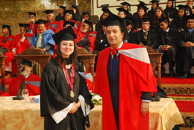
Lahore School Convocation Images